Weather Patterns in Saratoga, CA: Climate, Seasons, and Your Home Search
Saratoga, CA weather patterns shape more than your commute. Understand how fire zones, hillside drainage, and dry summers affect which homes to shortlist.
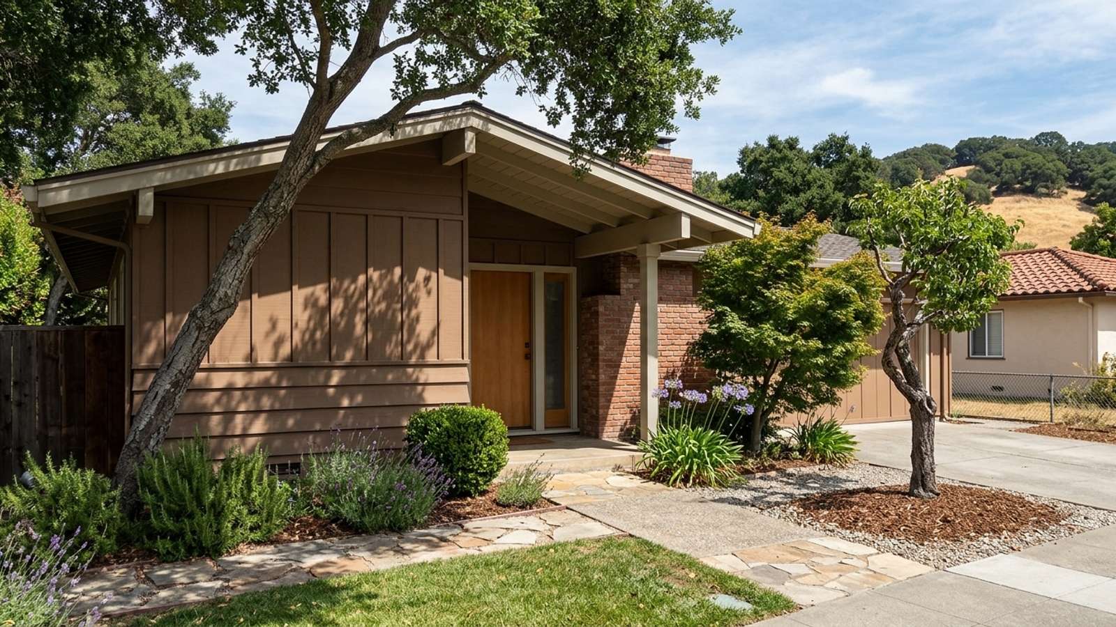
Saratoga has a warm-summer Mediterranean climate, and that's a genuine draw for buyers who want comfortable outdoor living most of the year. Mild winters, long dry summers, cool nights. It holds up well on paper and in person.
The climate question that separates one home from another, though, isn't whether Saratoga is pleasant. It's what a specific address brings with it. Fire hazard zones, hillside drainage, and summer heat vary by location, and those details need to land on your radar early, not during the inspection period.
Key takeaway
Saratoga has a mild, dry-summer climate, meaning weather rarely rules a home out. What varies is the address, as flatter, lower-elevation areas usually bring the fewest weather trade-offs, while hillside lots toward the Santa Cruz Mountains trade views for fire-zone rules and winter drainage checks. Single-family homes are selling in a median 19 days, so you should run these checks before you offer.
Who this guide is for
You're weighing a move to Saratoga and want to know how its weather, along with the fire, storm, and heat risks that come with it, should shape which part of town and which home you shortlist.
Saratoga weather year round
The year breaks into two main seasons rather than four. A wet, cool season runs roughly from November through March, delivering most of the year's rain and putting roofs and gutters to the test in a fairly compressed window. Then a long dry season takes over: warm afternoons, cool nights, and an outdoor living calendar that stretches for months, though it also drives up residential irrigation demands considerably.
Official 1991-2020 Climate Normals for the nearby Los Gatos station (elevation 365 feet) give you a sense of how mild the winter gets. January averages a high of 58.5°F and a low of 39.5°F; February edges up to an average high of 61.9°F.
What station averages don't tell you is how those numbers shift across Saratoga's elevation range. The flatter parts of town and the hillside lots are not the same climate, even though they share a zip code.
How elevation and the hills change local weather
Saratoga rises from the valley floor into the foothills of the Santa Cruz Mountains. The United States Geological Survey places the city's reference elevation at 423 feet above sea level, but the terrain climbs well beyond that. Properties higher on that slope generally see more rain and thicker vegetation.
For homeowners, those microclimates have practical consequences. Hillside lots tend to collect more water and grow more brush, which raises both fire fuel loads and drainage demands. Flatter, lower-elevation areas are more uniform and easier to maintain through the year.
You can match these patterns to specific areas by comparing Saratoga neighborhoods. The larger lots and privacy that hillside properties command a premium for usually come with higher fire-zone and slope obligations attached.
Fire season, smoke, and summer heat
Wildfire carries the biggest property consequences of any weather pattern in this region. The long dry season combined with offshore wind events creates peak fire weather typically from late summer into fall. CAL FIRE maps Fire Hazard Severity Zones based on fuel load, slope, and weather conditions to manage that risk.
The City of Saratoga adopted updated Local Responsibility Area maps effective February 24, 2025, designating properties into moderate, high, and very high fire hazard zones. Homes in a Wildland Urban Interface area face special fire protection measures and building requirements for new development. Ongoing maintenance obligations apply as well, including the Santa Clara County Fire Department's hazardous brush abatement program, which requires removing flammable vegetation to create defensible space.
Insurance availability and cost can shift considerably depending on those zone designations. Some owners who can't secure coverage through traditional carriers end up on the California FAIR Plan, the state's insurer of last resort, which provides basic fire coverage for properties in wildfire-threatened areas. Get an insurance quote before you release any contingencies.
Summer heat and smoke days from regional fires are part of daily life in affected areas too. The zone designation follows the house. It's a map classification, not a forecast, and it doesn't adjust based on what you paid.
How to look up a property's fire hazard zone
CAL FIRE's free online Fire Hazard Severity Zone viewer lets you check an address in a couple of minutes, well before you see the disclosure packet. Enter the address, note the zone and whether it falls under state or local responsibility, then confirm that finding against the Natural Hazard Disclosure report the seller provides.
From there, check with the Santa Clara County Fire Department for defensible-space rules that apply to that specific parcel. The map shows hazard classification, not insurability. Two homes in the same zone can get very different insurance quotes, so the lookup is a starting point, not a substitute for a real quote from a broker.
Winter storms, flooding, and hillside drainage
Saratoga gets most of its rain in a handful of large winter storms rather than steady year-round drizzle. When heavy atmospheric rivers move through the region, they put drainage systems, roofs, and retaining walls to the test quickly. Because no single flood-zone designation applies citywide, the City directs residents to FEMA's official Flood Map Service Center to look up a specific parcel.
Properties near waterways like Saratoga Creek need particular attention, and parcel-level flood hazard designations have to be confirmed through the FEMA map. Read the Natural Hazard Disclosure report carefully, and on sloped lots, ask whether a geotechnical or drainage report exists.
Drainage fixes, retaining wall repairs, and major tree work are significant costs. They don't announce themselves during a dry-season showing. The evidence has to come from documents and inspectors, not from what you can see walking through in July.
How to check a Saratoga home for weather risk before you offer
This market doesn't leave much time for research once a seller accepts your offer. For the 90 days ending September 30, 2026, 46.9% of single-family homes sold above list price, and supply sat at just 1.8 months. Run your property checks before you write a contract.
Start with the fire zone lookup, an insurance quote, and the FEMA flood map. For finalist homes, request the disclosure packet, roof and drainage history, and any defensible-space or tree records. You can compare how these steps fit into the broader process of buying a home in Saratoga.
- Are you shopping for a hillside lot with views or acreage? Read the sections on fire and winter storms first, because both risks rise with elevation and slope.
- Do you need a home that works through hot afternoons and smoke days without upgrades? Check the listing for HVAC details and review the air conditioning FAQ below.
- Are you competing on a home likely to sell over list? Get the hazard lookup and insurance quote done before you write.
- Is weather one factor among many in deciding on Saratoga at all? Review the year-round climate overview, then weigh the general pros and cons of living in Saratoga.
These checks connect to current Saratoga housing market trends and prices on a practical level. Doing this work on every home you like does take time and some money, so narrow your shortlist before you start.
At a glance
- Median sale price, single family: $4,298,286, up 0.4% year over year (90 days ending 2026-09-30, 65 sales)
- Median sale price, all homes: $3,863,160, down 2.4% year over year (90 days ending 2026-09-30, 79 sales)
- Median days on market, single family: 19 (90 days ending 2026-09-30)
- Median days on market, all homes: 18 (90 days ending 2026-09-30)
- Sale-to-list ratio, single family: 101.5% (90 days ending 2026-09-30)
- Share sold above list, single family: 46.9% (90 days ending 2026-09-30)
- Months of supply, single family: 1.8 (90 days ending 2026-09-30)
- Homes for sale, single family: 37; all homes: 52 (90 days ending 2026-09-30)
- Median price per square foot, single family: $1,584 (90 days ending 2026-09-30)
Is Saratoga's weather a good reason to live there?
The local climate is a real draw. A long dry season, mild winters, and essentially no snow make for comfortable year-round living. That said, this weather pattern isn't unique in the South Bay, so it should rarely be the single deciding factor between Saratoga and a neighboring town.
Sellers need to account for these patterns too, since they dictate the disclosures required when selling a home in Saratoga. If you need help pulling disclosure packets on finalist homes before you write an offer, Andy Tse's team can handle that research for you.
The trade-off is straightforward: the same dry season that makes summers pleasant is exactly what drives the area's fire-season obligations.
Saratoga, CA weather FAQs
What is the weather like in Saratoga, California?
Saratoga has a warm-summer Mediterranean climate, classified formally as Csb. That means mild, wet winters and long, dry, warm summers. The year-round section above has specific temperature averages for the coolest months.
What part of California has the best year-round weather, and how does Saratoga compare?
The answer depends on how you feel about heat and fog. Saratoga sits between the cooler, foggier coast and the hotter Central Valley, which gives it warmer summers than San Francisco but milder ones than the inland valleys. For reference, the nearby Los Gatos station shows a January average high of 58.5°F, so winters stay comfortable without the sharper coastal chill.
What's the average temperature in Saratoga, California?
Temperatures stay moderate through the year, though official figures come from nearby stations rather than within city limits. Data from the Los Gatos station (elevation 365 feet) shows a January average mean temperature of 49.0°F and a February average mean of 51.6°F. A property's specific elevation matters here, since hillside homes will run different daily averages than the valley floor.
Does it snow in Saratoga, CA?
Snow on the valley floor is rare. Occasional dustings reach the higher foothills of the Santa Cruz Mountains during unusually cold winter storms, but local homes are not built or equipped for snow accumulation.
Is it humid in Saratoga, CA?
It depends on the season and time of day. Summers are generally dry with low afternoon humidity. Mornings and the winter rainy season feel considerably more humid.
Does Saratoga lose power during PG&E shutoffs?
Yes. Saratoga has been affected by PG&E Public Safety Power Shutoffs. The utility can cut power to areas under extreme fire weather to prevent wildfires, and the City notes those outages could last longer than two days. Look up a specific address on PG&E's outage map and ask the seller about past shutoffs and any backup power systems on the property.
Do homes in Saratoga need air conditioning?
It depends on the home's elevation, shade, and construction. Many owners value central cooling and air filtration for hot spells and regional smoke days. Confirm the HVAC type and age in the listing and during your home inspection.
What is the best time of year to move to Saratoga?
From a weather standpoint, late spring and early summer tend to combine dry roads with lower fire-weather risk. Moving during peak red-flag periods in late summer and fall can complicate your schedule, and big winter storms between November and March can delay roof and drainage inspections.
Sources
- Redfin: Data Center
- NOAA: 1991-2020 Climate Normals
- Plantmaps: Köppen Climate Classification
- TopoZone: Saratoga Topographic Map
- City of Saratoga: Fire Hazard Severity Zone Map
- City of Saratoga: Fire Prevention
- California Department of Insurance: FAIR Plan Fact Sheet
- City of Saratoga: Winter Storms and Flood Map Service Center
- City of Saratoga: Public Safety Power Shutoff