Weather Patterns in Los Gatos, CA: Seasons, Rain, and Valley vs. Hills
In Los Gatos, CA, weather patterns shift by altitude. Valley floors stay warmer and drier; hillside homes mean more rain, fire zones, and storm-road risks.
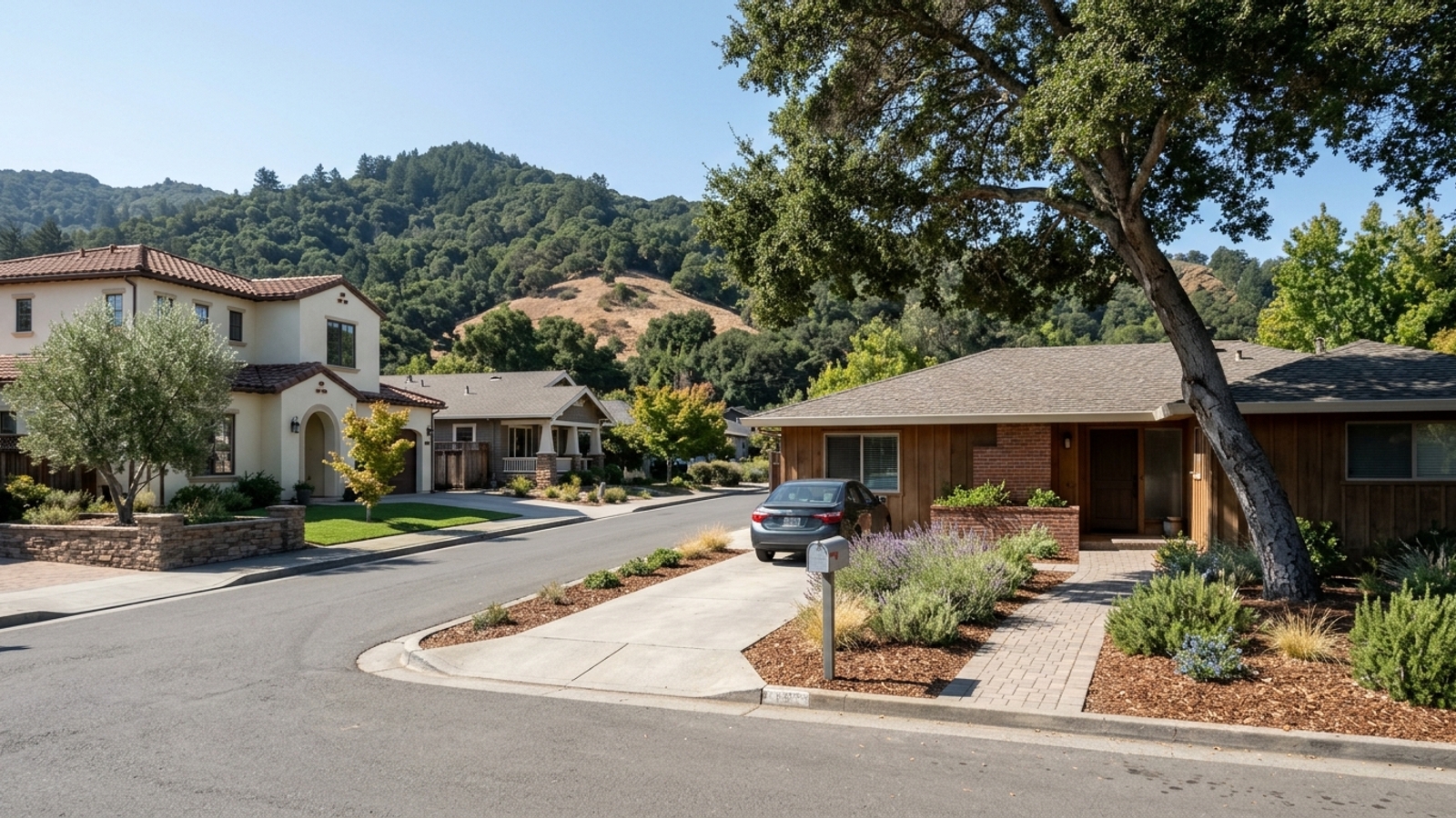
Los Gatos does not have one weather pattern but two. Valley-floor neighborhoods near downtown get mild, dry summers and comparatively little rain. Hillside and Santa Cruz Mountain addresses get more rain, colder winter nights, storm-road closures, and mapped wildfire hazard zones.
The town center sits at an approximate elevation of 344 feet above sea level. The terrain rises quickly as you move south and west into the mountains, changing the climate within a few miles. Single-family homes still sell at 104.2% of list in a median of 22 days, so check an address's weather exposure before making an offer, not after.
Key takeaway
Los Gatos has a mild, dry-summer Mediterranean climate, but the weather you live with depends on elevation. Valley-floor neighborhoods near downtown are warmer, drier, and easier to reach in winter, while hillside homes trade views and cooler nights for more rain, storm-road closures, and wildfire-zone rules. With 56.8% of single-family homes selling above list, check an address's hazard maps and get an insurance quote before you make an offer.
Who this guide is for
You're considering a move to Los Gatos and want to know how the weather changes across town before you choose between a valley-floor home and a hillside one.
Los Gatos weather year round: why elevation matters
The baseline climate across town is mild and driven by the nearby Pacific Ocean. Weather stations track the averages, but local topography splits Los Gatos into distinct microclimates. Where you land on the slope matters more than people expect.
If you're comparing properties, look at elevation first. A house near downtown will have a genuinely different weather profile than one sitting high on a ridge, sometimes within a few miles of each other.
What kind of climate Los Gatos has
Los Gatos is classified as a warm-summer Mediterranean climate: dry, warm summers and cool, wet winters. The official NOAA station sits at 365 feet of elevation and is the source for town-wide averages. For January, the normal high is 58.5°F and the normal low is 39.5°F. February's normal high reaches 61.9°F.
Those averages describe the valley floor. They can meaningfully understate how cold and wet hillside addresses get when winter storms move through.
Valley floor vs. hillside weather
Downtown and flatland neighborhoods get the baseline Mediterranean climate: less rain than the hills, warmer winter nights, easier roads. Higher elevations in the Santa Cruz Mountains catch more precipitation as storms roll in from the coast, and these hillside addresses also see more fog and wind exposure. If you want to see where these areas sit relative to each other, you can review neighborhood locations and boundaries.
What you give up for the views and the cooler nights is convenience: more rain on steep lots, longer drives in winter, and stricter fire-zone rules.
Los Gatos weather by season
Summer and winter define the local lifestyle. Spring and fall are short transitions. Pay attention during tours to how a property handles the extremes: August heat and January rain are the two that tend to reveal a home's weak points.
Summer in Los Gatos
Summers are dry, with warm afternoons and cooler nights. July and August bring near-zero rainfall, which dries out hillside brush and native vegetation fast.
Many older homes were built without central air conditioning. Confirm the cooling system during showings and don't assume it's there.
The dry heat also puts defensible-space inspections and vegetation management squarely on the homeowner's calendar, every year.
Fall in Los Gatos
Fall is often the warmest and clearest stretch of the year. It also brings offshore wind events, known locally as Diablo winds, which blow from roughly August through early December. These winds prompt Red Flag Warnings from the National Weather Service when strong winds, low relative humidity, and warm temperatures combine to create a high risk of extreme fire behavior.
The catch: the nicest days of the year overlap with peak fire weather and the window when power shutoffs are most likely.
Winter in Los Gatos
Winter is the rainy season. Days are cool, nights are chilly, and frost occasionally forms on the valley floor, while the hills drop lower still. January is typically the coldest month, with a normal mean temperature of 49.0°F at the downtown station. Storms roll through in waves, dropping the majority of the year's precipitation.
Atmospheric-river storms can turn a normal week into days of heavy rain. Hillside residents feel that first, on their steep roads and driveways.
Spring in Los Gatos
Spring is a brief window when the rain tapers off and the hills go green. It's a good time to tour homes specifically to check how well a property drained after the wet season: look at the roof, gutters, and downhill slopes. Drainage issues are usually visible in March and April if they exist.
The green hills dry out quickly, though. By early summer that grass is brown, which is why defensible-space inspections typically land in spring.
Rain and fog in Los Gatos
Precipitation varies wildly from year to year. Averages hide big swings between drought years and storm years, and a home that looked dry in a drought year may show leaks in a wet one. Ask the seller for the roof's age and gutter history. Look at the home after a rainstorm if you can arrange it.
How much rain falls in Los Gatos
Rain is concentrated in winter months, and the valley floor gets less of it than the hill gauges in the Santa Cruz Mountains. Because it arrives in concentrated bursts rather than steady drizzle, drainage and roof condition matter more than they would in a uniformly wet climate: water needs a clear path away from the foundation.
Averages don't tell the whole story. Plan for heavy storm years even when you're buying in a drought.
Fog and the marine layer
Coastal fog spills over the Santa Cruz Mountains regularly, reaching higher elevations first before either burning off or settling into the valley. That marine layer provides natural cooling on summer mornings and keeps ridge-top homes noticeably more comfortable than the valley floor during heat waves.
The downside is lingering moisture. Fog that cools a home can also mean damp decks and moss on shaded, north-facing roofs, so inspect wood surfaces carefully.
Weather risks to check before you buy in Los Gatos
Single-family home values fell recently, yet houses still sell in a median of 22 days. That pace leaves little room to circle back on due diligence after an offer is accepted. Run your weather and hazard checks before you write, not after. The state and town provide specific map lookups for every property.
Wildfire hazard zones
The Town of Los Gatos adopted a Fire Hazard Severity Zone map in June 2025, built from CAL FIRE modeling. It designates Very High, High, and Moderate hazard zones, largely concentrated in the southern and western hillside areas. State law mandates 100 feet of defensible space around buildings in Very High zones, and the town's local wildland-urban interface ordinance also requires a 5-foot nonflammable zone for new construction around structures in these areas.
A fire-zone designation can narrow your insurance choices and add ongoing upkeep costs. Get a homeowners insurance quote and ask the seller for a CLUE report before you write an offer.
Winter storms and Highway 17
Winter storms regularly hit commuters heading over the Santa Cruz Mountains. Caltrans District 4 has repeatedly closed lanes and sometimes the entire length of Highway 17 due to storm damage. Starting March 30, 2023, Caltrans performed daytime lane closures on Highway 17 between Blossom Hill Road and Summit Road to remove fallen trees, and that work continued through mid-April.
A hillside home can be minutes from downtown in good weather and much farther during a storm. Drive the route to work or school on a winter weekday before committing to a hillside address.
Creek flooding and hillside slides
Two localized water risks affect specific addresses: FEMA flood zones and mapped landslide hazard areas. The Los Gatos Creek stream corridor is designated Zone A on the town's FEMA flood map, with surrounding areas marked Zone D. On steep lots, the town restricts projects in State of California Seismic Hazard Zones and geologically hazardous areas, and a large area of Los Gatos has moderate to high landslide potential, primarily across the southern portion of town.
A lender can require flood insurance if the home sits in a FEMA flood zone. On hillside lots, a geotechnical report can add cost and time. Check the FEMA map and ask about drainage disclosures early in the process.
How to choose a part of Los Gatos by weather
Choosing where to live comes down to which weather trade-offs you want to make. A few questions about your daily routine will point you in the right direction. Reviewing the pros and cons of living in Los Gatos can help guide your decision.
- Are you willing to live with wildfire-zone building rules, defensible-space upkeep, and a harder insurance search? If not, focus on valley-floor neighborhoods near downtown and the flatter areas toward Highway 85. Start here if you want warmer, drier weather with easier winter access.
- Will you drive Highway 17 or winding hill roads on winter workdays, or need reliable power for working from home? If you want cooler summer nights, views, and more land, look at hillside and Santa Cruz Mountain addresses off Highway 17. Just plan for the insurance and defensible-space checks before you offer.
- Is the home near Los Gatos Creek or on a steep lot? Check the FEMA flood map lookup for each address before adding it to your shortlist. Start here if you want a home near Los Gatos Creek and the trail without a flood-insurance requirement.
If you want to talk through how these weather factors affect home styles and construction, or compare the buying process and prices in Los Gatos, you can also weigh whether Los Gatos is a good place to live by looking at costs and schools.
Los Gatos home prices at a glance
At these prices, an insurance quote or a geotechnical report is a small cost next to a costly surprise. Here's a look at recent market figures to help you set your budget. If you're comparing ZIP codes 95030, 95032, 95033 and surrounding areas, these numbers set the baseline.
- Median sale price, all homes: $2,438,839, down 3.4% year over year (90 days ending 2026-09-30)
- Median sale price, single-family homes: $2,873,854, down 7.3% year over year (90 days ending 2026-09-30)
- Sale-to-list ratio: 104.2% for single-family homes and 102.4% for all homes (90 days ending 2026-09-30)
- Share sold above list: 56.8% of single-family homes and 45.3% of all homes (90 days ending 2026-09-30)
- Median days on market: 22 for single-family homes and 26 for all homes (90 days ending 2026-09-30)
- Months of supply: 3.1 for single-family homes and 3.5 for all homes (90 days ending 2026-09-30)
- Median price per square foot: $1,334 for single-family homes and $1,209 for all homes (90 days ending 2026-09-30)
- Homes sold: 45 single-family and 65 total; inventory: 45 single-family and 73 total (90 days ending 2026-09-30)
Los Gatos weather FAQs
What is the coldest month in Los Gatos?
January is typically the coldest month in Los Gatos. According to NOAA's 1991-2020 Climate Normals for the local station, the normal January low is 39.5°F. Hillside addresses run colder at night than the valley floor.
What is the temperature in Los Gatos today?
Check the National Weather Service point forecast for Los Gatos for live conditions. For context, the normal high during January is 58.5°F, while February reaches a normal high of 61.9°F.
Was 2026 a wet year in Los Gatos?
It depends on the gauge, but early data showed dry conditions. Per Valley Water's Monthly Water Tracker for the metro area, September 2026 rainfall at the San José gauge totaled 0.04 inches, or 19% of the historical average for that month. Valley Water's cumulative rainfall year total through early fall stood at 15% of the average to date.
Does it snow in Los Gatos?
Snow is rare on the valley floor. Occasional dustings reach the higher Santa Cruz Mountain ridges during cold winter storms, but measurable accumulation in town is not a regular occurrence.
Is it humid in Los Gatos?
Los Gatos generally experiences low humidity, especially in the afternoon during the dry summer months. The marine layer can bring higher humidity and fog to the hills in the morning, but it typically burns off quickly.
Does Los Gatos lose power often?
Yes, parts of town are subject to Public Safety Power Shutoffs (PSPS) during high wind and low humidity events. Portions of Los Gatos experienced PG&E's first-ever PSPS event in early October 2019, and the town has continued to be included in planning areas through 2026. Look up an address's outage history and ask if the home has backup power.
Which parts of Los Gatos have the least natural hazard risk?
Hazard exposure is set address by address, rather than by neighborhood. You'll need to check the CAL FIRE fire hazard map, the FEMA flood map, and the state's seismic and landslide hazard zones for each property. Sellers will also provide earthquake fault disclosures via the state Natural Hazard Disclosure statement.
Is Los Gatos a good place to live?
Yes, the dry-summer climate is a major draw, but your elevation decides your exposure to fire zones and winter storms. With single-family homes selling at a median of $1,334 per square foot, the cost of entry is high. You can compare the lifestyle, costs, and schools to see if it fits your goals.
Sources
- Redfin: Data Center
- NOAA NCEI: Climate Normals
- TopoZone: Los Gatos
- ZipDataMaps: 95030
- Patch: Red Flag Warning
- California Legislative Information: Government Code 51179
- California Legislative Information: Government Code Chapter 6.8
- Town of Los Gatos: PG&E PSPS
- Caltrans: Highway 17 Lane Closure
- Town of Los Gatos: Hydrology and FEMA Flood Map
- Town of Los Gatos: Hillside Standards
- Valley Water: Monthly Water Tracker