Getting Around Los Gatos, CA: Driving, transit, and commute options
Getting around Los Gatos, CA means planning for your address. Hillside homes are car-only, while downtown offers walkable errands and Creek Trail bike access.
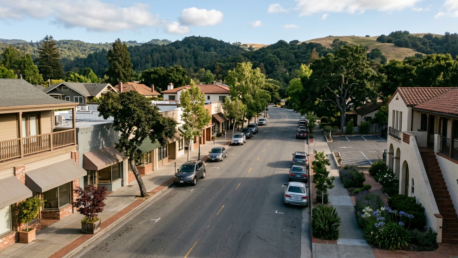
Los Gatos, CA sits at the southwest edge of San Jose at the base of the Santa Cruz Mountains. Its position where Highway 17 meets Highway 85 means that moving in and out of town requires understanding local traffic patterns and transit limits before you commit to an address.
Getting around here is decided by your address, not the town name. Only homes within reach of downtown or the Los Gatos Creek Trail can trade some car trips for walking or biking. Hillside addresses are car-only, no rail line enters town, and single-family homes sell in a median 22 days, so you need to test your real commute before you tour seriously, not after you go into contract.
Key Takeaway
Plan on a car for most trips in Los Gatos. The exception is an address within walking distance of downtown or the Los Gatos Creek Trail, where errands on foot and a bike commute toward Campbell are realistic. Test your actual commute before touring seriously, because single-family homes sold in a median 22 days over the 90 days ending September 30, 2026.
Who This Guide Is For
You're weighing a move to Los Gatos and need to know whether your daily trips for work, errands, and airport runs will be car-only or partly on foot, bike, or transit before you narrow your home search.
Do You Need a Car in Los Gatos?
For most households, yes. How much you drive depends on exactly where you live within the town limits. Addresses near the downtown core or the paved creek trail offer the chance to swap some driving for walking and biking. Homes in the foothills don't offer those alternatives, and regional transit requires a drive to a neighboring city first.
To figure out which parts of town fit your daily routine, work through a few practical questions:
- Where do you work, and how many days a week do you go in? If your office is in Silicon Valley, review the highway and bus options. If you commute to San Francisco, look at the regional train connections.
- Do you want to run errands on foot? Review the downtown walking and parking sections, then filter your home search by walking distance to the center of town.
- Would you bike part or all of a commute? Look at the Los Gatos Creek Trail access points and check the route from any address you're seriously considering.
- Are you drawn to hillside lots for space and views? Review the hillside roads section and plan to drive the route at commute hour before you write an offer.
Getting Around Los Gatos Without a Car
Leaving the car at home is possible in specific pockets of town. You need to know where the infrastructure supports it and where it stops.
Walking in Downtown Los Gatos
The downtown core around North Santa Cruz Avenue and Main Street is the most pedestrian-friendly part of town. Local dining, shops, and the farmers market are all here, making it the one spot where running errands on foot is realistic. The town's Bicycle and Pedestrian Master Plan identifies a new Highway 17 Bicycle and Pedestrian Overcrossing near Blossom Hill Road as its highest priority to improve connections, with other planned improvements including sidewalk infill and crosswalk enhancements.
Walkability drops off fast once streets climb or sidewalks end. A house that looks close to downtown on a map can sit at the top of an uphill walk; walk the route from the listing yourself before you decide it works.
Biking the Los Gatos Creek Trail
The Los Gatos Creek Trail is a paved route linking Los Gatos with Campbell and San Jose, keeping much of a northbound bike ride off surface streets. You can ride toward Campbell and San Jose largely on this creekside path instead of sharing lanes with commuter traffic.
The trail is shared with walkers, runners, and dogs, and it gets crowded on weekends. It only helps if your workplace lies along its path, and you'll still need a safe street connection from your front door to a trail access point.
VTA Buses and the Nearest Light Rail
The Santa Clara Valley Transportation Authority (VTA) runs local bus service in Los Gatos. Route 27 is the main line serving the town, running through downtown toward Winchester Station and Santa Teresa Station. Based on the 2026 schedule, Route 27 operates roughly every 30 minutes on weekdays from about 6:00 a.m. to 9:30 p.m., with frequency dropping to every 45 to 60 minutes on weekends. For eligible riders with disabilities, VTA ACCESS paratransit operates a shared-ride, door-to-door service within three-quarters of a mile of these fixed routes, plus an additional one-mile premium service area.
Light rail stops short of Los Gatos at Winchester Station in Campbell. The planned Vasona extension into town is currently paused due to high costs and projected low ridership. Most job centers require a transfer, and bus frequency is limited, so transit for most residents means driving to Winchester or a park-and-ride lot first. Check the current schedule against your actual hours before you count on it.
Driving and Parking in Los Gatos
Most residents rely on driving for daily trips. Your experience behind the wheel depends on your proximity to the freeways, the downtown parking zones, or the mountain roads.
Highway 17 and Highway 85
Highway 85 runs across the South Bay, connecting residents to Silicon Valley job centers. Highway 17 heads north into San Jose and south over the Santa Cruz Mountains to the coast.
On summer weekends, Santa Cruz-bound beach traffic on Highway 17 spills onto Los Gatos streets. Town data shows roughly 24% of Highway 17's traffic volume cuts through local neighborhoods during peak summer weekend hours, compared to about 6% on weekdays. In response, the town has implemented short-term measures including prohibiting right turns into the Almond Grove neighborhood on Saturdays from 10 a.m. to 3 p.m. and setting up a Beach Traffic Hotline. A home close to Highway 17 trades fast freeway access for seasonal congestion, and the route over the mountains is winding and prone to slowdowns and closures.
Parking in Downtown Los Gatos
Public parking in the downtown area is regulated by time limits. Most on-street spaces and some lots enforce a two-hour limit from 9 a.m. to 6 p.m., Monday through Saturday. Certain municipal lots allow three-hour parking, and a pay-to-stay ordinance lets visitors pay a fee to park beyond the free limit. The town also manages a Residential Permit Parking program and a downtown employee permit program for specific zones.
Living near downtown means sharing your street with visitors, especially on weekends and market days. Check whether the block is in a permit zone and how many off-street spaces a home has before assuming you can park on the street.
Hillside Roads and Car-Only Addresses
Homes in the Santa Cruz Mountains foothills offer larger lots and privacy, but they're entirely car-dependent. These areas lack sidewalks and bus service, requiring longer drives for basic errands. Every trip, including a run for a gallon of milk, starts with a drive on narrow, winding roads.
Drive the route at commute hour and in the dark before you make an offer. Look the address up on CAL FIRE's official fire hazard severity zone map.
Airports and Regional Trains Near Los Gatos
For air travel, the driving distance to Norman Y. Mineta San Jose International Airport (SJC) is approximately 11 miles. San Francisco International Airport (SFO) is about 40 miles away. Both trips start with a drive, an airport shuttle, or a rideshare from Los Gatos, which makes your proximity to Highway 17 or Highway 85 a real factor in your travel time.
San Francisco commuters can connect to Caltrain at San Jose Diridon station. Caltrain's electrified Express service connects San Jose Diridon to San Francisco in about one hour. Because no train stops in Los Gatos, you'll need to drive or take a bus to Diridon to start this commute.
How Your Commute Should Shape Your Los Gatos Home Search
Single-family home values in Los Gatos fell 7.3% year over year, which gives you some room to negotiate on price. Properties still sell quickly, though, spending a median 22 days on the market and closing at that pace even as prices dipped. A well-located home won't wait while you test the drive. Evaluating the pros and cons of living in Los Gatos helps clarify your priorities before touring.
Map your work location and frequent errands from your shortlisted properties. Drive your commute from each address at the actual hour you'd travel on a weekday. Walk or bike from the listing to downtown and to the nearest Creek Trail access point instead of trusting map distance. You can review the local cost of living and compare neighborhood price breakdowns to see how these locations fit your budget.
If you plan to use transit, check the current VTA schedule for the route nearest the home against your work hours. If you'd use the Highway 17 Express or a park-and-ride, confirm current stop locations with the operator before relying on them. Ask the Town of Los Gatos whether the street is in a residential parking permit zone, and confirm the home's off-street parking. Andy Tse can help match available listings to the commute you want.
At a Glance
- Single-family median sale price: $2,873,854, down 7.3% year over year (45 sales, 90 days ending Sept. 30, 2026)
- All homes median sale price: $2,438,839, down 3.4% year over year (65 sales, 90 days ending Sept. 30, 2026)
- Single-family median days on market: 22 (all homes: 26), 90 days ending Sept. 30, 2026
- Single-family sale-to-list ratio: 104.2%, with 56.8% of homes selling above list (90 days ending Sept. 30, 2026)
- Single-family months of supply: 3.1, with 45 homes in inventory (90 days ending Sept. 30, 2026)
- Median price per square foot: $1,334 single-family, $1,209 all homes (90 days ending Sept. 30, 2026)
Getting Around Los Gatos FAQs
Where Is Los Gatos, California Located?
Los Gatos sits at the southwest edge of San Jose at the base of the Santa Cruz Mountains, where Highway 17 meets Highway 85. You can compare local zip codes to see how different areas position you for commuting.
What County Is Los Gatos, CA In?
Los Gatos is in Santa Clara County. The county agency VTA runs the town's buses and paratransit, including Route 27, which operates through the downtown area.
How Far Is Los Gatos from San Jose and San Francisco?
The driving distance to Norman Y. Mineta San Jose International Airport is about 11 miles, while San Francisco International Airport is approximately 40 miles away. Test your travel time at peak hour rather than quoting a single mileage estimate.
How Much Does the Bus Cost in Los Gatos?
It depends on how you pay. VTA's adult single-ride fare is $2.50 using cash or a Clipper card, and a day pass is $7.50 via Clipper or EZfare. Clipper riders also receive two hours of free transfers with a single-ride fare, though you should check for any changes before riding.
How Long Is the Drive from Los Gatos to Santa Cruz?
It depends on the day and time you travel. Summer weekend slowdowns on Highway 17 can add significant time to the trip over the mountains. The Highway 17 Express bus travels this route, but it doesn't have a listed scheduled passenger stop within Los Gatos itself.
Is There a Park-and-Ride in Los Gatos?
It depends on current local transit routes. Check 511.org and VTA for any active park-and-ride lots in or near town and what services they connect to before planning your daily commute.
Sources
- Redfin: Data Center
- VTA: Frequency Chart
- VTA: Fares
- San Jose Spotlight: Vasona extension
- VTA: ACCESS Paratransit
- Wikipedia: Highway 17 Express
- Town of Los Gatos: Bicycle and Pedestrian Master Plan
- Town of Los Gatos: Parking resolution
- Town of Los Gatos: Beach traffic measures
- Travelmath: Airport distances
- Caltrain: Status